
3D Laser Scanning
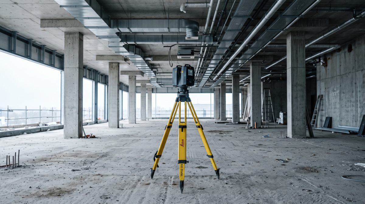
A tripod-mounted scanner set up in position after position through a space, registered together into one point cloud. What you receive is the processed dataset — drawings, models and comparison are separate services built from it.
- What it costs
- Quoted per scope
- Also called
- laser scanning · 3D scanning · point cloud · scan a building · existing conditions scan · Leica RTC360 · FARO
Where it earns its keep
Use it for these.
If your problem is “i need dimensional detail of a building that already exists,” this is the answer.
- Existing buildings before renovation or fit-out
- MEP coordination in congested ceilings
- Feeding a model rather than a photograph
- Spaces where dimensional detail is the whole point
Don’t use it for this
Weekly progress, or anywhere a photograph settles the question. Scanning earns its cost when the geometry is the point.
We put this on every service page because the fastest way to waste your money is to buy the impressive tool instead of the correct one. If the row above describes your job, say so on the call and we’ll point you at the right one — including when it’s cheaper than this.
Find the right one by problem →What you receive
And what it opens in.
- Processed and registered point-cloud dataset
- Agreed file format, chosen against the downstream workflow
- Defined project coverage and extents
- Project metadata: capture dates, areas covered, units, reference basis where one applies, file manifest
- Processing notes: registration summary, coverage limitations, known occluded or inaccessible areas
Included every time
Formats
E57 · RCP · LAS · PTS
Format is agreed against what you do with the data next — these are the ones this service commonly delivers in, not a promise of every format on every project. Delivered to a shared project folder anyone on the job can open: no accounts, no per-seat charge, and if you leave, the record leaves with you.
The boundary
Where this scope ends.
Options on this scope
- Additional point-cloud formats
- Hosted or viewer access
- Colorized data
- Panoramic imagery where the instrument supports it
- Alignment to your project coordinate system
A separate Kinetic service
- Scan-to-CAD & Measured DrawingsFloor plans, ceilings, elevations and sections drafted from this cloud.
- 3D ModelingThe same conditions as geometry, for visualisation or context.
- Scan-to-BIMA structured model authored from this cloud.
- Design vs. Installed VerificationHolding this capture against the coordinated design model.
- Digital twin & VR walkthroughsKeeping the captured geometry navigable after handover.
Not something Kinetic does
- Licensed surveying of any kind
- Engineering interpretation of what the data shows
- Design services
- Compliance or code certification
- Structural analysis
- Anything requiring a professional stamp
Where a project needs one of these, we say so and point you at someone licensed to do it.
Before we can price it
What we’d ask you.
Kinetic confirms the scope with you before anything is scheduled. None of it is a form to fill in — it is what the conversation covers.
- What will this data be used for?
- Do you need drawings, a 3D model, BIM, or the point cloud itself?
- Which areas have to be captured, and which can be left out?
- Is the space occupied, and when can we be in it?
- Is there an existing coordinate system or project datum we should work to?
What changes the size of the job
- Capture area
- Number of levels
- Geometric and MEP complexity
- Access restrictions and available working hours
- Occupied or active site conditions
- Number of site visits required
- Required deliverables and downstream use
- Coordinate or reference requirements
- Schedule
Useful to have, none of it required to start
- Project location
- Approximate area
- Floors or levels involved
- Which areas are to be captured
- Interior, exterior or both
- Intended use of the data
- Desired output
- Project schedule or deadline
- Access restrictions
- Whether the space is occupied or under active construction
- Any drawings or models that already exist
- Client coordinate requirements, template, downstream software or project standards, where these apply
Where we run it
Markets this shows up on most.
Aviation & transportation
Long programs, staged handovers and heavy reporting obligations. Airspace here is genuinely complex and it is planned for, not discovered on the day.
Aviation & transportation projectsOil & gas
Tank farms, pipe racks, flare stacks and terminals — drone visual passes instead of scaffold and rope access, scan-based existing conditions for brownfield tie-ins, and turnaround documentation while everything is open.
Oil & gas facility capture
What this runs with.
All services →Scan-to-BIM
Turn the registered cloud into a model your team can actually work in.
Quoted per scopeDesign vs. Installed Verification
Lay the scan over the coordinated model and see where the two disagree.
QuotedMobile & Handheld Scanning
Cover far more ground per hour, where continuous walking capture suits the building.
Quoted per scopeScan-to-CAD & Measured Drawings
The commonest next step: turn the cloud into floor plans and elevations, no model required.
Custom scope · technical review
Tell us the job. We’ll tell you if this is the right tool for it.
Send the project — an address, a schedule, or just what you’re trying to document. A person reads it and comes back with an approach and a price.
Scope your project